


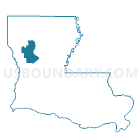
Precinct 4-6, Natchitoches Parish, Louisiana
About
Outline

Summary
| Unique Area Identifier | 589725 |
| Name | Precinct 4-6 |
| County | Natchitoches Parish |
| State | Louisiana |
| Area (square miles) | 107.81 |
| Land Area (square miles) | 107.61 |
| Water Area (square miles) | 0.20 |
| % of Land Area | 99.82 |
| % of Water Area | 0.18 |
| Latitude of the Internal Point | 31.44940180 |
| Longtitude of the Internal Point | -92.97542730 |
Maps


Graphs
Select a template below for downloading or customizing gragh for Precinct 4-6, Natchitoches Parish, Louisiana


Neighbors
Neighoring Voting District (by Name) Neighboring Voting District on the Map
- Precinct 3-9, Natchitoches Parish, LA
- Precinct 4-4, Natchitoches Parish, LA
- Precinct 4-5, Natchitoches Parish, LA
- Precinct 4-7, Natchitoches Parish, LA
- Precinct 6-1, Vernon Parish, LA
- Precinct S1, Rapides Parish, LA
- Precinct S2, Rapides Parish, LA
Top 10 Neighboring County Subdivision (by Population) Neighboring County Subdivision on the Map
- District E, Rapides Parish, LA (16,480)
- District 6, Vernon Parish, LA (3,612)
- District 10, Natchitoches Parish, LA (3,553)
- District 11, Natchitoches Parish, LA (3,552)
Top 10 Neighboring Unified School District (by Population) Neighboring Unified School District on the Map
- Rapides Parish School District, LA (131,613)
- Vernon Parish School District, LA (52,334)
- Natchitoches Parish School District, LA (39,566)
Top 10 Neighboring State Legislative District Lower Chamber (by Population) Neighboring State Legislative District Lower Chamber on the Map
- State House District 25, LA (46,800)
- State House District 30, LA (43,935)
- State House District 23, LA (41,224)
Top 10 Neighboring State Legislative District Upper Chamber (by Population) Neighboring State Legislative District Upper Chamber on the Map
- State Senate District 31, LA (117,370)
- State Senate District 30, LA (116,727)
- State Senate District 29, LA (111,461)
Top 10 Neighboring 111th Congressional District (by Population) Neighboring 111th Congressional District on the Map
Top 10 Neighboring Census Tract (by Population) Neighboring Census Tract on the Map
- Census Tract 9501, Vernon Parish, LA (5,447)
- Census Tract 106, Rapides Parish, LA (4,938)
- Census Tract 9, Natchitoches Parish, LA (4,665)
- Census Tract 8, Natchitoches Parish, LA (4,453)
Top 10 Neighboring 5-Digit ZIP Code Tabulation Area (by Population) Neighboring 5-Digit ZIP Code Tabulation Area on the Map
- 71457, LA (27,809)
- 71446, LA (22,762)
- 71447, LA (1,469)
- 71468, LA (868)
- 71416, LA (842)
- 71427, LA (413)
- 71455, LA (227)